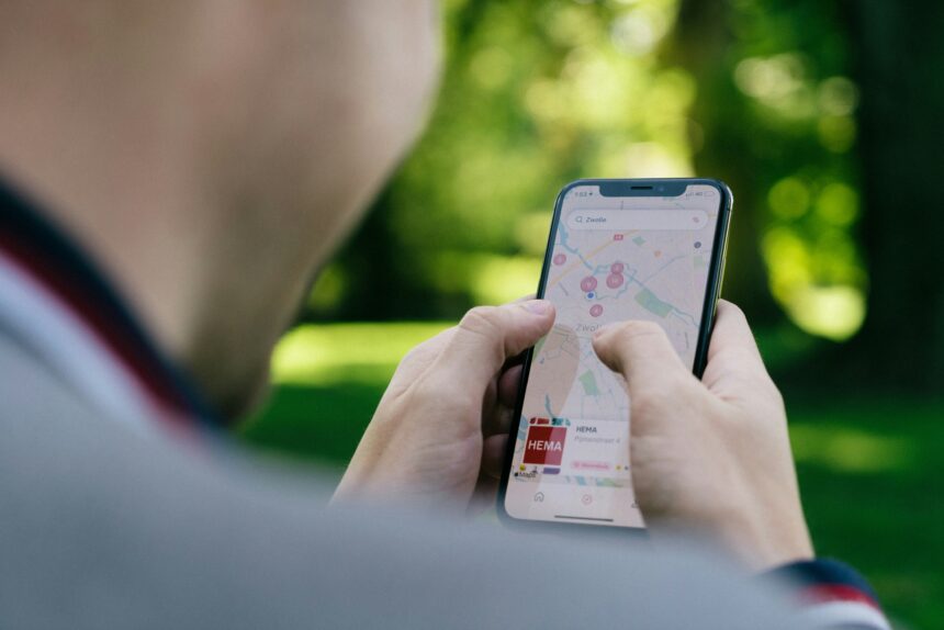
There’s a moment, if you’ve ever followed a navigation app into a parking garage or a dense downtown block, when the little blue dot simply gives up. It drifts. It hesitates. It places you half a block from where you’re actually standing, and no amount of waiting or phone-waving fixes it. Most of us blame the signal. A few blame the app. Almost nobody blames the engineers who designed the system and who, in a very deliberate way, built imprecision into it from the start.
That imprecision isn’t a bug. It never was.
The Global Positioning System, which the United States military began developing in earnest in the 1970s, was designed first and foremost as a weapons-guidance and military navigation tool. Accuracy was the whole point. The satellites could, under the right conditions, place a receiver within a matter of feet. That level of precision made GPS extraordinarily useful for military operations and, in the minds of the people running those operations, extraordinarily dangerous in the wrong hands.
So they turned the accuracy down.
The mechanism had a name: Selective Availability. It worked by introducing a controlled, randomized error signal into the timing data broadcast by GPS satellites. Civilian receivers picked up the degraded signal and got positioning that was off, sometimes by hundreds of feet (roughly 100 meters or more), while military hardware used a separate, encrypted signal that bypassed the noise entirely. For years, if you were a civilian with a GPS device, you were navigating with a map that had been quietly, officially blurred.
The Switch That Changed Everything

Selective Availability stayed on for roughly a decade. Then, in May 2000, President Clinton’s administration switched it off. The improvement was immediate and dramatic. Overnight, consumer GPS accuracy jumped from something like 100 meters of error to roughly 10 to 20 meters. Hikers, drivers, and boaters who had been living with the degraded signal suddenly had a device that actually knew where it was.
And here’s the strange part: even after Selective Availability was switched off, GPS was still wrong. Not by hundreds of feet anymore, but wrong enough that a blue dot on a map isn’t quite you, it’s a probability cloud around you. The system hasn’t failed. That’s simply how satellite geometry, atmospheric physics, and the speed of light work together, and it turns out those three things don’t cooperate as neatly as the marketing materials imply.
The core problem is time. GPS works by measuring how long a radio signal takes to travel from a satellite to your phone. Multiply that travel time by the speed of light, and you get a distance. Get distances from several satellites at once, and you can triangulate your position with impressive precision. The math is elegant, and it works. But radio signals don’t travel through the atmosphere at a perfectly constant speed.
The ionosphere, the upper layer of the atmosphere, slows them down, and how much it slows them down depends on solar activity, the time of day, the season, and a dozen other variables that shift constantly. A signal that arrives a billionth of a second late translates to a positioning error of roughly a foot. Errors compound.
Why Your Phone Map Still Drifts

Your phone is cheating. In the best possible way. Modern smartphones fuse GPS satellite data with cell tower readings, Wi-Fi positioning, and onboard accelerometers all at once, running that calculation dozens of times per second. When a building cuts the satellite signal, the phone doesn’t freeze. It pivots to whatever’s left and makes its best guess. Usually, that guess is close enough. Sometimes it puts you in the middle of a river.
The drift you see in a parking garage is your phone admitting, in the most polite way possible, that it has lost the thread. The blue dot wanders because the software is interpolating. It knows where you were. It doesn’t know where you are. So it estimates, based on direction and speed, and the last known position, until a signal comes back and corrects the record. Engineers call this dead reckoning. Sailors have used the same basic logic for centuries, keeping track of where they started, how fast they’re moving, and in what direction. The phone just does it in milliseconds.
There’s something quietly remarkable about that. A technology sophisticated enough to receive signals from satellites orbiting roughly twenty thousand kilometers above the earth still falls back, in the tunnels and the canyons, on the same mental arithmetic a fifteenth-century navigator used crossing the Atlantic.
The Error That Was Always the Point

Here’s the thing. The engineers who built GPS never thought it was perfect. They knew about the atmospheric interference, the geometric blind spots, the signal-blocking problem. They also knew that precision was its own kind of danger. A system accurate enough to guide a missile is accurate enough to guide a threat. So they built in an off-switch for precision and used it for years. When the calculus changed, they flipped it. That’s not negligence. That’s a real engineering decision made by real people weighing real consequences.
The blue dot you follow to the nearest coffee shop has a stranger biography than most people imagine. Its design ran through satellite engineers, military planners, and a 2000 presidential order before it ever reached your pocket. Every assumption those people made is still baked into the system you trust to get you home.
Next time it drifts, and it will drift, it might be worth a moment of mild appreciation. Not for the error. For the fact that the whole thing works at all.
This article was researched, written, and edited by our human editorial team. AI tools were used in a limited research-assistant capacity. All claims were independently verified.


